'New Districts' part two report
- Mar 1, 2024
- 11 min read
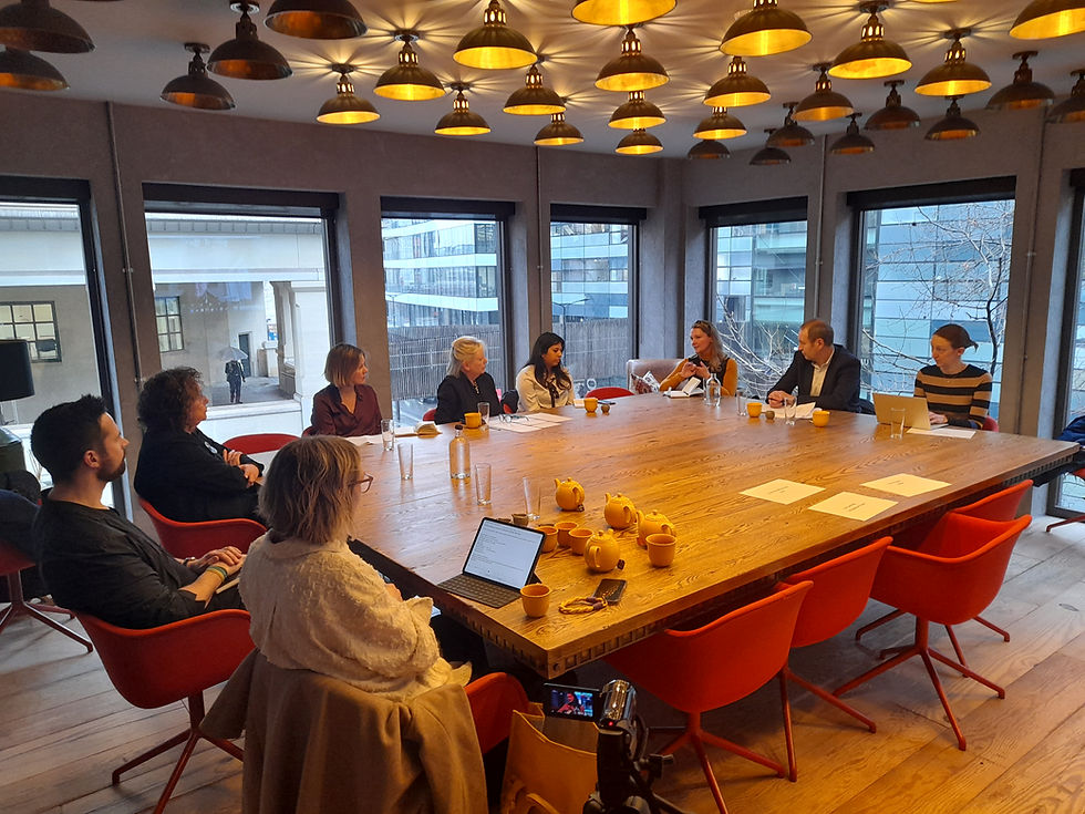
Future Cities Forum met contributors in the City of London to discuss 'New Districts'
How can the planning of new districts in cities combat climate change, how can housing be designed to provide cooler homes during periods of extreme heat, should there be further protection from building on greenbelt and how can our famous London shopping streets become better spaces for cyclists and healthier travel?
These were some of the questions that were put to our contributors in the second half of our 'New Districts' debate held in the City of London.
Future Cities Forum discussed Arup's work on heat maps in London, the phase one of the masterplan for Earl's Court with Sheppard Robson, greenbelt development with economics consultancy, Volterra, designing for healthy lifestyles in cities with HOK and the current work to 'green' Oxford Street with BDP.
Arup has been working on mapping districts in London that suffer from high temperatures and looking at building materials that might help to cool buildings. The consultancy has been describing how 'concrete buildings, tarmacadamed roads, steel and glass structures, air conditioning units, traffic congestion… these and many other factors are heating up our cities.'
To help urban planners and city authorities bring down the temperature – the urban heat island effect (UHI) – Arup has developed UHeat. It’s a new digital tool that uses a combination of satellite imagery and open source climate data to analyse huge areas of cities. It’s able to identify the particular buildings, structures and materials that are causing temperatures to rise.
Arup states that 'UHeat doesn’t just reveal where UHI hotspots are developing. Our teams translate analysis into new planning solutions, ones that can reshape a city’s use of land and materials. These include recommendations for nature-based interventions that will bring down the temperature without the need for additional building and structures.
'UHeat is built on data science and the latest academic microclimate modelling, developed by our partners at UCL and University of Reading. It’s just one way we’re helping cities to respond to the climate crisis. The Urban Heat Snapshot analysed the temperature in the urban centres of seven cities: Cairo, London, Los Angeles, Madrid, Mumbai, New York and Singapore.'
At a city level, Arup's work revealed that:
Madrid had the most severe UHI hot spot, at 8.5°C hotter than its rural surroundings
UHI can vary drastically neighbourhood to neighbourhood: cities saw up to an 8°C UHI swing within short distances
In majority of cities, the hottest spots had less than 6% vegetation cover – while the coolest spots in most cities had over 70%
Three of the cities studied experienced their worst UHI hot spots during the evening or night-time

Above: Tower Hamlets is a London borough which is vulnerable to higher heat risk (Image courtesy Bouygues UK)
A landmark report produced by Arup mapped London's heat risk across homes, neighbourhoods and essential properties in the wake of climate change, informing the Mayor of London’s plans for resilience.
Global sustainable development consultancy Arup was commissioned by the Mayor of London to produce new research assessing properties and residential neighbourhoods vulnerable to heat risk in the capital. The Properties Vulnerable to Heat Impacts in London report looks at which of the city’s ‘essential properties’ such as schools, hospitals, care homes, residential buildings and neighbourhoods would be most impacted during periods of high temperatures.
The report, commissioned by the Mayor of London, also shows there is a direct correlation between a higher heat risk and areas that have greater socio-economic vulnerabilities. The research shows which boroughs have the most heat risk for schools:
Boroughs such as Islington, Hackney and Tower Hamlets show the greater heat risk for schools.
Areas towards the outskirts such as Hillingdon, Kingston Upon Thames, Bromley and Barnet show the least heat risk.
The hotspot seen in the north of Enfield is attributed to high socioeconomic vulnerability and higher property vulnerability for schools in this area.
while for residential development:
There is a higher heat risk for residential properties in neighbourhoods in central boroughs such as Hackney, Tower Hamlets, Islington and Camden. These boroughs tend to have a higher proportion of flats, which are considered to be more vulnerable to overheating, compared to outer London boroughs which have a higher proportion of houses.
Areas towards the outskirts such as Bromley, Havering and Hillingdon show the lowest heat risk to residential properties.
Arup Associate Dimple Rana explained to Future Cities Forum that the vulnerability to heat is largely seen in the east side of the Capital where more heat exposure has been mapped:
'This work really matters because there is evidence that London is suffering extreme heat conditions in the east because of building types and flats in particular are more vulnerable to heat. Largely it is the inner London boroughs that are at risk.
'While some of this is due to the history of the east end and how building typologies have emerged, this data is of the 'now' and these are areas that we need to prioritise.
'Older people and those with health conditions will be most affected and it is important that we look at building materials when designing homes that can mitigate against high temperatures. Some materials retain heat as will the use of dark colours in design. We need to be careful to plan for the inclusion of more trees and blue infrastructure and how we design our public realm.'
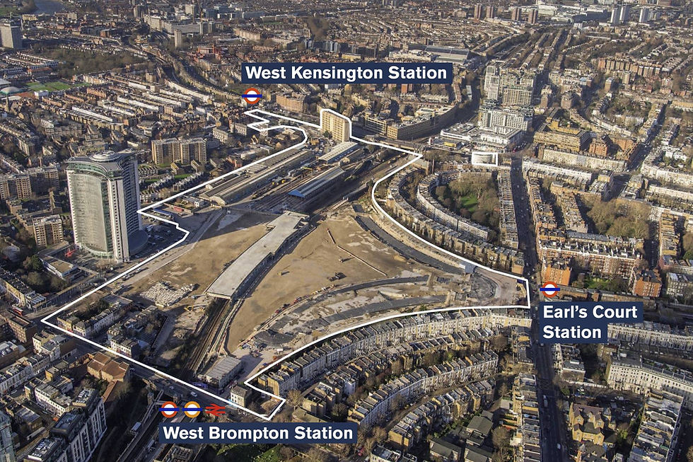
Image courtesy of Sheppard Robson showing the area to be developed in the Earl's Court masterplan
Sheppard Robson is working on the first phase of the redevelopment of the Earls Court Exhibition Centres site, leading the Hammersmith & Fulham part of phase 1 that will create a strong relationship with the neighbouring West Kensington and Gibbs Green Estates.
Its work involves close collaboration with Serie Architects and dRMM as well as the masterplanners for the wider development. Its site includes a series of residential buildings, creating homes for sale, for rent and for students. New homes will sit above a podium which will house a mix of workspaces, retail, amenities and community centre.
The designs will sit close to the new park at the heart of site and next to a new tree-lined boulevard that helps stitch the mix of uses together and fulfils one of the development’s key aims – to prioritise people and nature.
Anna Shapiro, Partner at Sheppard Robson, told the forum:
'At Earls Court the ambition is highly sustainable, creating a new neighbourhood with its own park. We realised that the area lacked its own civic infrastructure and the plan is for four thousand homes while protecting 'green'.
'We realised that we need to go high rise and in the phase one of the masterplan that we are working on, we want to develop new high rise typologies with a dual aspect in every single home. This is generally not something that is seen today but is an important ambition.
'Each home should have natural ventilation and green areas on terraces and balconies which is very challenging to achieve with other demands involved. There will be some communal gardens and play areas. The provision of doorstep play in addition to the park for secure environment for children to play plus areas of shading are also part of our designs.
'Today as architects we are moving away from glass towers and we have the opportunity to look at heat reduction in glass in addition.'
Recently the Planning Portal reported that the Levelling Up, Housing and Communities Committee has been looking into how lack of space for children affects their mental and physical wellbeing. It has heard that there should be clearer planning guidance on delivering spaces for the young. It reported:
'The committee is holding an inquiry to look at how better planning and building and urban design in England could enhance the health and wellbeing of children and young people.
It wants to find out more about how children and young people experience outdoor spaces in towns, cities and rural areas, as well as what policy interventions from local and central government could help to deliver streets, estates, villages, neighbourhoods and parks that enable kids to enjoy active outdoor lifestyles and engage with others.'

Peterborough aerial view mock-up showing proposed riverside stadium, courtesy of Peterborough City Council
The discussion between the UK government and local authorities continued around the use of greenbelt versus brownfield for development and Future Cities Forum brought Ellie Evans, partner at economics consultancy Volterra into the debate to ask her views on which is better for planning sustainable housing:
'I have worked on green belt developments but I find the term a rather catch-all title. There are lots of these sites that do not have a strong green policy offer. I am not pro either green or brownfield development exclusively but I do think there should be a study of green belt to see which developments should be taken further rather than creating new sites on green belt. I do think brownfield has a role to play to deliver social rented homes. There is a dearth of them and there are some sites that should be used for this.
'You have either got to have the private sector which wants to deliver great places and holds workshop sessions where the community has its say or aspirational councils regenerating cities. I have worked with both Hadley Property Group and Peterborough City Council in this way.
'Peterborough City Council has a good growth strategy for regenerating the city and has levelling up funding for work around the station, but its is very small in terms of money and not enough to transform. When you come out of the station there is a huge amount of surface car parking and the site is under developed. How does a council attract developers with funds to help in these situations?
'In terms of house building, density and place-making means different things to different people. I believe density is a good thing and I think we need to look at how to design high-quality public realm around tall buildings rather than go back to low rise.'
'Transport congestion also means different things to different people and what might appear congestion in Cambridge might not be in London. Cambridge has a particularly good system of cycle way because of its student population. I just think we haven't done the planning properly in other cities.'

HOK's design principal, David Weatherhead joined the discussion to talk about how to plan for healthier living in cities.
HOK has been working on designs that transform underutilized land along the Piccadilly and District London Underground lines into a vibrant live-work community.
Ealing Council approved a master plan for redeveloping a half-mile-long, narrow stretch of land along Bollo Lane, W4, in Acton, West London .The development will provide 852 new homes, including 50 percent affordable housing, and is being delivered by Transport for London (TfL).
Designed by HOK, the scheme consists of an undulating, accessible series of buildings ranging from 4 to 25 stories. The tallest one is a mixed-use tower near Chiswick Business Park that will be built alongside the Piccadilly line tracks. The proposed development includes a new train crew accommodation building for Piccadilly line drivers.
A new green corridor linking the Acton Town and Chiswick Park underground stations is central to the scheme. A series of public spaces and private terrace gardens will line a human-scaled colonnade that connects ground-level offices, makerspaces, shops and cafés.
A dedicated service road runs along the tracks, supporting a ‘healthy streets’ approach and ensuring that Bollo Lane will be free of lay-bys and provide a safe pedestrian experience.
'Our approach to placemaking and high-quality architecture seeks to reinforce the identity of the neighborhood and celebrate urban living while ensuring a lasting legacy for this development,' said David,
'It’s an exciting new way of thinking about transforming the underutilized parcels of land that are so common around London’s transport infrastructure into wonderful spaces that enrich people’s lives.'

Image: Bollo Lane, west London, courtesy of HOK
The design draws inspiration from the history and commitment to design excellence of TfL, which has helped shape modern London. The design team has looked to the legacies of Frank Pick, first chief executive of London Transport, and architect Charles Holden, who together in the early-20th century developed an iconic architectural identity for the city’s transport system.
To inform the scheme, the team undertook an extensive public engagement process that included several public and pop-up exhibitions for residents and transport users and a newsletter/email outreach campaign.
'Along with the climate emergency, the pandemic has brought to the forefront the importance of having an abundant amount of pedestrian-friendly and green spaces in our cities,” said David 'We look forward to continuing to work with Transport for London, Ealing Council members and residents to bring to life this vision for a new kind of sustainable live-work community.'
David told the forum:
'We are all trying to create places where we are happier in nature and conscious of rising temperatures. Housing is one element but developers have an up-hill struggle.
'From Sweden where I lived and worked to London or Newcastle, it is challenging. Sweden is low density but the requirements are different. But generally, we stay on planning too long in the UK. Do we want to change our cities to promote healthy living which involves reducing inefficiencies. We need to look deeper and work out simple upgrades say to the local transport system, that could make a lot of difference.
'Take the borough of Newham which has the highest child obesity rates in London. It is vital that outdoor spaces are suitable for all cultures that all people can find activity in. Sweden's population is not as diverse as the UK, so we have to work harder to do more and get active. Our road systems and cycle ways are not working well. We need to make our cities full of nature.'

Roads leading off Oxford Street could continue to improve their 'greening'
Traffic management and bringing nature back into our historic shopping streets was a topic that BDP's Chair of Landscape Design, Nick Edwards, discussed at the forum.
Westminster City Council and its partners at MCJV have started the process of delivering ambitious plans for the reinvention of London's Oxford Street. BDP's landscape architecture team is supporting the council and the wider consultant team in making the ‘nation’s high street’ greener, safer and cleaner.
The measures include designs for pocket parks and seating areas to encourage visitors back to the West End post pandemic and create a welcoming, safe environment for residents, workers and visitors.
The work started when lockdown restrictions eased and the new, biophilic, experiential external environments have acted to help retailers, restaurants, cafes and other businesses in the area to bounce back, stronger.
The initial project transformed the look and feel of Oxford Street and improve the air quality in the area. The first phase of work saw bus bays consolidated to make space for dwelling space and lighting installations.
Nick Edwards, said:
'The new designs on Oxford Street will support the safe movement of pedestrians whilst ensuring that vibrant, lush greening and new seating enhances the experience of, what is arguably, London’s most famous retail destination.
'Even though these measures are temporary, Oxford Street has a bright future - we are providing more places for people to dwell, incorporating green infrastructure, promoting more sustainable modes of transport and enhancing the ability for retail companies to engage with, and trade within the external environment. The results will be outstanding.'

Image: CGI Oxford Street transformation, courtesy of Westminster City Council
Nick explained to the forum that BDP had been working on a series of proposals for a long time to transform Oxford Street and the firm had learned a lot from the pandemic:
'Back in 2016 you would see half a million people on Oxford Street and there were times when it got very busy and those peaks were when you had to deal with safety. You need space for all sorts of users including cycling. Highways are spaces available and they are covered in dark asphalt. Not everyone walks where you want them to and we need to take more space away form the highway to provide cycling that is comfortable for everyone.
'Not all cyclists like having to brave the buses. We have key cycle networks being built north and south and we have to look at the management of the red line in money terms. How can we connect up cycle ways from outside into the London network. How can we do this to accommodate all cyclists. Not everyone wants to move fast.
'We also need to look at how to make cycling safe at night and work with the BIDs on this. We need to create environments that are attractive. If something looks uncared for you will feel less safe. There is a lot of work being done on meanwhile uses. We also need the right kinds of trees. We worked on Windsor Great park and it allowed us to experiment with different tree types from the Mediterranean. It has made us more confident about using different trees in our cities in climate change. We also need to think about the building materials we use and challenge British standards on for example how thick pavements should be. We need flexibility if we are going to change our cities for the better.'
Future Cities Forum would like to thank all our contributors for their important insight to the debate around the development of new districts.
Below: Oxford Street at night.

Above: Oxford Street at night
Comments